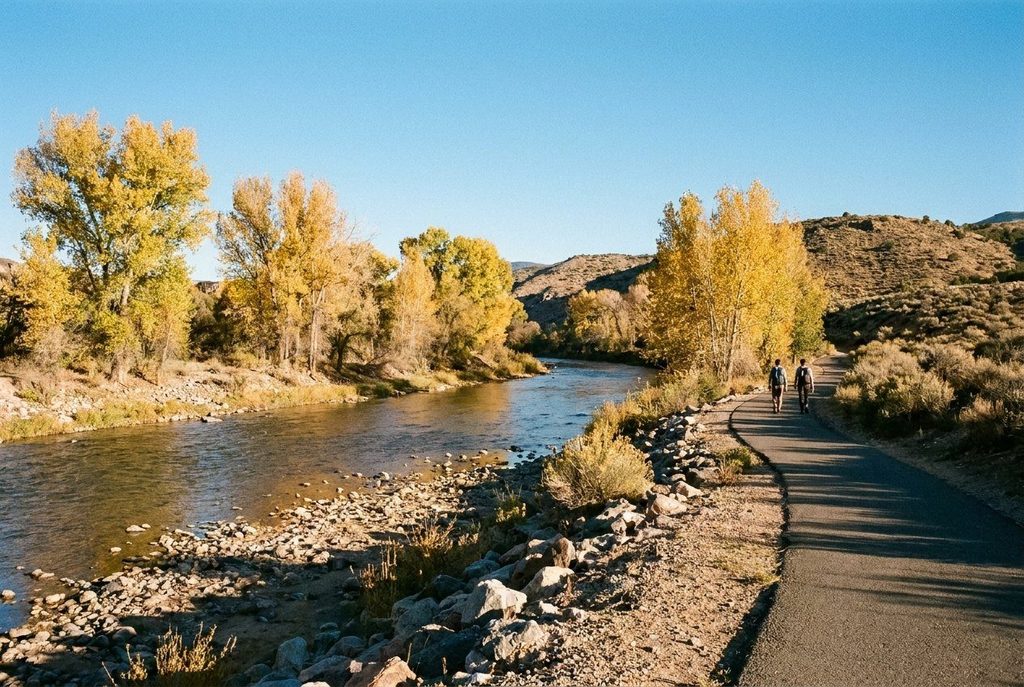
The Navajo name for the place means among the waters. Three rivers join here, and the green strip they make runs right through the middle of a desert town.
- Where to see it
- Riverside parks along the Animas and the town museum
- Look for
- The cottonwoods: their line on the horizon shows where each river runs, green in summer and gold in autumn.
Farmington is the largest town in San Juan County, and the first thing to understand about it is water. The Animas River comes down from the San Juan Mountains of Colorado and meets the San Juan River here, and the smaller La Plata joins just to the west. The Navajo name for the place, Tóta', is usually translated as among the waters. In a high-desert country of mesas and sage, that meeting made the valley a farming place long before the town was named for it in the late 1800s.
Along the rivers
The best way into Farmington is on foot beside the Animas. A paved trail follows the river through a chain of parks, under tall cottonwoods and past ponds and wetlands. It is flat, shady in summer and busy with birds: herons in the shallows, kingfishers along the banks and, in winter, ducks and geese on the open water. A nature centre on the river has displays on the wildlife and the river itself.
Walk early in summer, when the desert heat builds quickly by midday. In autumn the cottonwoods turn gold, usually from mid-October, and the trail is at its best.
The town museum
Farmington's museum, beside the river, covers the region's story from its geology and ancestral Puebloan past through Navajo history, homesteading, the railway and the energy industry that shaped the modern town. It also hosts art exhibitions, often including work from the region. It makes a good first stop for context before a day out in the country around.
Read alongsideSilver and turquoise: how Navajo silversmithing beganA base for the crafts country
Farmington sits at the edge of the Navajo Nation, which begins just west of town, and within easy reach of most of the places on this site. From here:
- Aztec Ruins is about 20 minutes north-east and Salmon Ruins about 15 minutes east. Both are covered in the story on their pottery.
- Shiprock is about 45 minutes west, and the Bisti/De-Na-Zin Wilderness about an hour south; see Shiprock and the Bisti.
- The weaving country around Two Grey Hills lies about an hour and a half south-west, along the foot of the Chuska Mountains.
- Mesa Verde, in Colorado, is about an hour and a half north-west, across the state line.
The town of Shiprock holds the Northern Navajo Nation Fair each autumn, one of the oldest and largest fairs on the Navajo Nation, with a parade, rodeo, traditional song and dance, and a great deal of weaving, silver and other work by Navajo makers. Dates are set each year.
Altitude, fuel and three jurisdictions
Farmington sits at about 1,600 metres, so summer days are hot and dry but nights cool off, and winter brings cold mornings with bright sun. Distances between places are long and services thin out quickly on the reservation roads, so fill the tank before heading out and carry water. Remember that you are often crossing between state land, federal land and the Navajo Nation, each with its own rules on photography, alcohol and access. Signs at the boundaries say what applies.
Getting there: uS-64 or US-550, Four Corners Regional Airport. Bring: walking shoes for the river trail. More in the country around it. Pictures are credited on the pictures page.