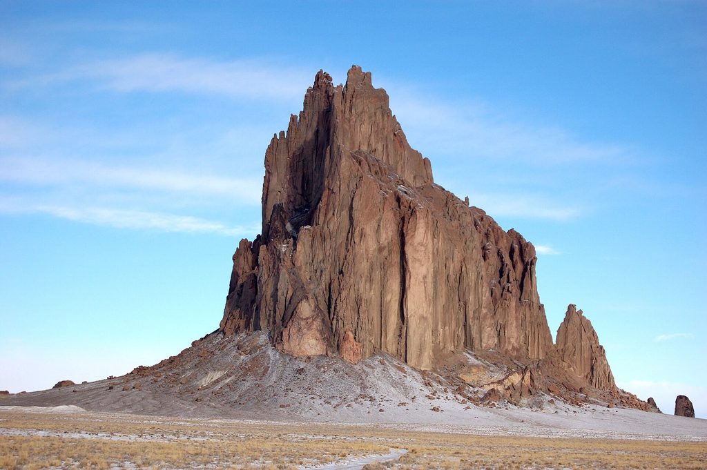
A dark volcanic peak alone on the plain, and a wilderness of striped clay hills an hour south: two landscapes that have drawn painters and photographers for a century.
- Where to see it
- From the public roads around Shiprock, and on foot in the Bisti/De-Na-Zin Wilderness
- Look for
- The long walls of rock running out from Shiprock across the plain: dikes of hardened lava from the same eruption.
Much of the art made in the Four Corners begins with the land, and two places near Farmington show why. One is a single peak you can see from fifty kilometres away. The other is a maze of low clay hills you only find by walking into it.
Shiprock
Shiprock rises about 480 metres above the plain west of the town that shares its name. In Navajo it is Tsé Bitʼaʼí, the rock with wings, and it holds a central place in Navajo stories and ceremony. Geologists call it a volcanic neck: the hardened throat of a volcano whose cone eroded away millions of years ago, leaving the tougher rock that once filled its vent. Long, narrow walls of the same rock, called dikes, run out from it across the flat land like the spokes of a wheel.
The peak is on the Navajo Nation and is sacred. Climbing has been banned since 1970, and the land around it is not open for walking without permission. You do not need to go closer than the roads. US-491 passes to the east, and a smaller road runs south-west of the peak. The views from both change hour by hour: black against a pale morning sky, red-brown in the low sun of late afternoon, and sharp-edged after rain.
Shiprock is one reason the area figures in so much regional painting and photography, and it appears in the background of countless weavings and silver pieces too. The weaving country of Two Grey Hills lies to the south, with the peak visible from much of it.
Read alongsideBlack on white: the old pottery of Aztec and Salmon RuinsThe Bisti/De-Na-Zin Wilderness
About an hour's drive south of Farmington on NM-371, the Bisti/De-Na-Zin Wilderness protects badlands: soft layers of clay, sandstone, shale and coal laid down about 70 million years ago, now worn into mushroom-shaped hoodoos, striped mounds and gullies. Petrified logs lie where they weathered out. Fossils of animals from the late age of dinosaurs have been found in the rocks. The wilderness is managed by the Bureau of Land Management.
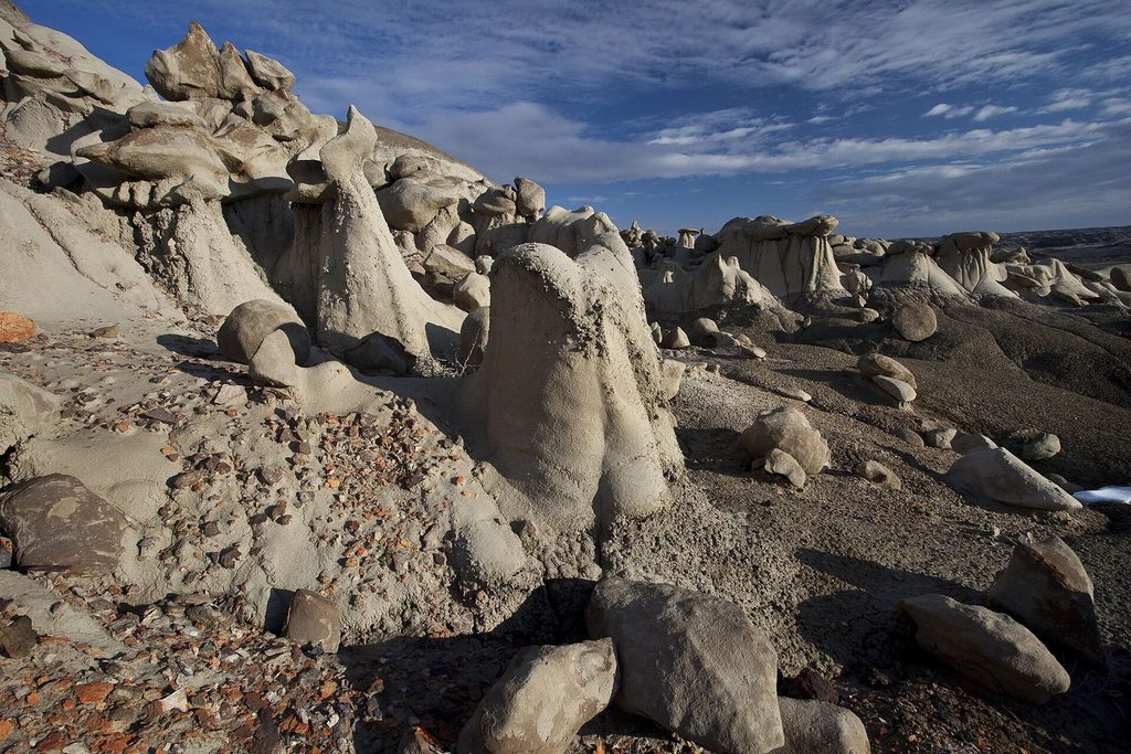
There are no marked trails. From the small parking areas you walk into a wash and follow it, which is the whole charm and also the main risk: every gully looks like the next.In summer the ground heat is fierce and there is no shade. After rain, the clay turns to slick mud and the access roads can be impassable.
Light, seasons and leaving it as it is
Painters and photographers come for the low light of early morning and late afternoon, when the hoodoos throw long shadows and the bands of colour in the clay show best. Midday light flattens everything. Spring and autumn are the comfortable seasons; winter can be bright and cold with occasional snow.
- Take nothing: petrified wood, fossils and rocks stay where they are. Collecting in a wilderness area is against federal law.
- Do not climb on the hoodoos. Their caps balance on soft clay and break easily.
- Camp only where rules allow.
Farmington is the natural base for both, with Shiprock about 45 minutes west and the Bisti about an hour south.
Getting there: uS-64 west; NM-371 south from Farmington. Bring: water, a compass or GPS, sturdy shoes. More in the country around it. Pictures are credited on the pictures page.